

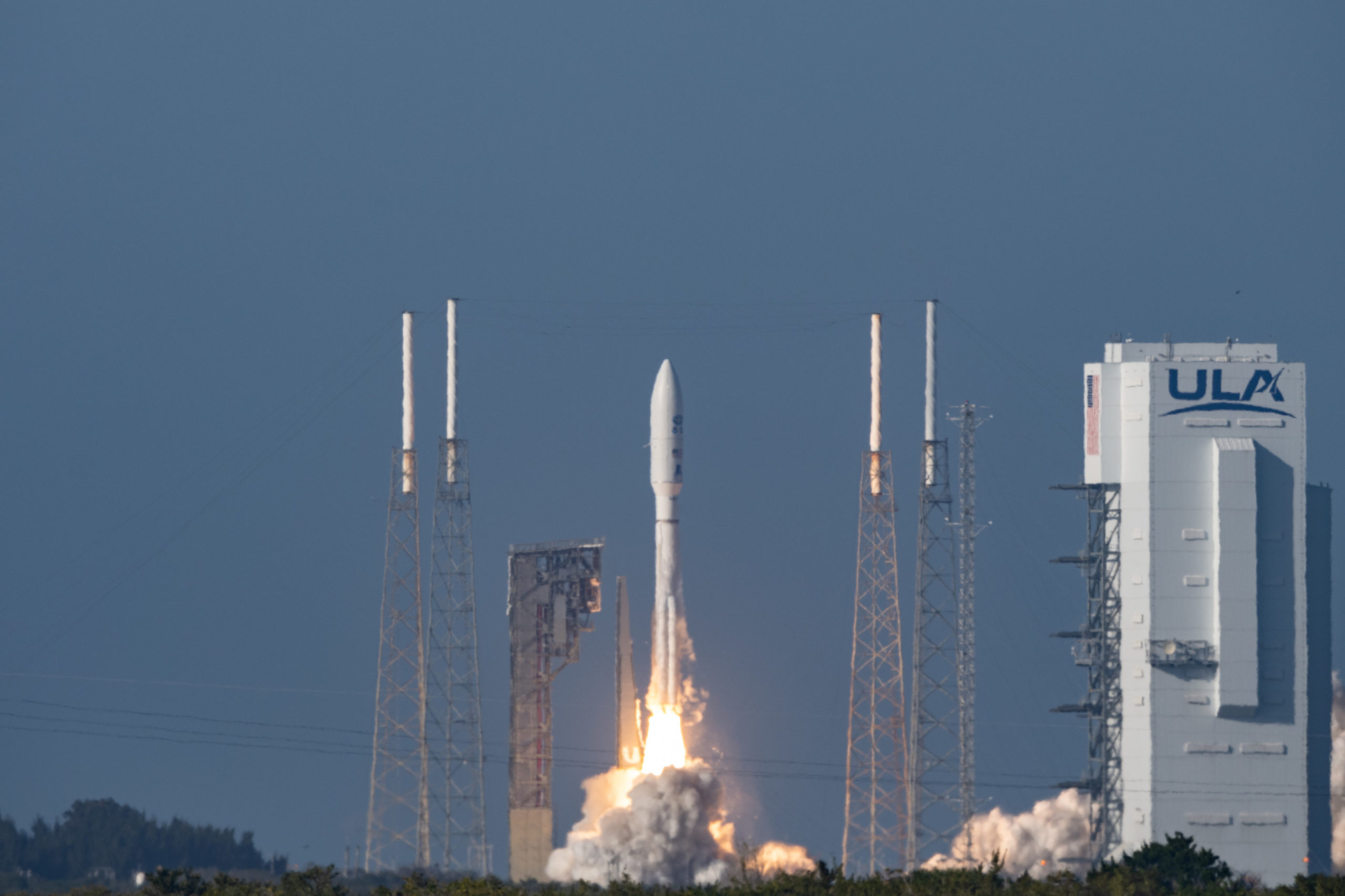
The Geostationary Operational Environmental Satellite (GOES-T), an advanced weather satellite built by Lockheed Martin [NYSE: LMT] for the National Oceanic and Atmospheric Administration (NOAA) was successfully launched from Florida’s Space Coast.
“GOES-T’s launch is the culmination of innovative engineering, science and strong teamwork between NASA, NOAA and Lockheed Martin,” said Jagdeep Shergill, Lockheed Martin’s GOES-R chief engineer and program manager. “With the impact climate change has on weather patterns around the world, the work of satellites like GOES-T is more crucial than ever before, to help keep people safe now and in the future.”
GOES-T will be renamed GOES-18 when it reaches geostationary orbit. Once operational, GOES-18 will take GOES-17’s place tracking atmospheric rivers, floods, wildfires, drought, and other severe weather and climate phenomena over the West Coast of the United States.
Advanced Monitoring of Weather, Oceans and Climate
As climate change continues to drive more frequent and severe environmental impacts, the GOES-R satellite series – of which GOES-T is the third – uses sophisticated technology to put information in the hands of those who need it most, when they need it.
Before it starts collecting and sharing critical weather data, the satellite’s journey to space began in Littleton, Colorado, where it was designed and built by Lockheed Martin engineers.
Based on Lockheed Martin’s novel A2100 satellite bus design, the spacecraft features two high-tech instruments built by the company’s Advanced Technology Center in Palo Alto, California:
- Geostationary Lightning Mapper (GLM), which is a first-of-its-kind operational lightning mapper flown into its orbit, tracking lightning across the US in real-time. By collecting data on the frequency, location and extent of lightning discharges, GLM allows meteorologists to quickly identify intensifying storms and take appropriate action. In 2020, GLM captured alightning megaflash nearly 500 miles long that broke the world record for longest lightning flash.
- Solar Ultraviolet Imager (SUVI), focuses on space weather and measures the sun in extreme ultraviolet wavelength range and provides solar images. SUVI is essential to understanding active areas on the sun and predicting solar events that may disrupt power utilities, communication or navigation systems here on Earth.
Over its 10-year operational lifetime, GOES-T can produce over a terabyte of data per day and monitors severe weather continuously, supporting NOAA’s mission to provide weather data to save lives.